 Filter: Categories of Wisconsin Historical Images
Filter: FORMAT_DIMENSIONS of 35 x 52 cm
Filter: Categories of Wisconsin Historical Images
Filter: FORMAT_DIMENSIONS of 35 x 52 cm
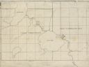
| Date: | |
|---|---|
| Description: | This 19th century manuscript map shows First Lake, Second Lake, streams, and sections in the towns of Dunn and Pleasant Springs, Dane County, Wisconsin. |
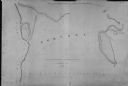
| Date: | 1839 |
|---|---|
| Description: | This map oriented with north to the upper right shows portage between the Wisconsin and Fox Rivers, as well as line of proposed construction for defense ag... |
If you didn't find the material you searched for, our Library Reference Staff can help.
Call our reference desk at 608-264-6535 or email us at: